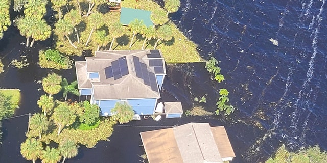
Experts predict Florida river could remain flooded for more than a month

In the aftermath of Hurricane Ian, rising lakes and rivers in Florida continue to submerge cities. According to the National Weather Service, the unprecedented flooding of at least one river may not recede until after Thanksgiving.
At least 1,200 people in Seminole County have been impacted by storm damage and flooding, which authorities say was caused by the St. Johns River and its tributaries. The St. Johns River is the longest river in the state of Florida.
According to FOX35 Orlando, the National Weather Service said that the river has peaked in various locations between Orlando and Jacksonville and that its decline would be gradual.
“The water at all of the points is starting to gradually decline, so we do see that very optimistically that the water is starting to recede, but it is very slow,” NWS meteorologist Jessie Smith told the station.
The National Weather Service in Melbourne has predicted a fifty percent chance of showers and thunderstorms for Wednesday, which may make the situation with the standing water and flooding in the St. Johns River Basin worse.
Earlier this month, people living in flooded houses in Geneva had to be rescued by emergency personnel as floods continued to rise even after the storm had gone.
Lieutenant Bobby Smith of the Seminole County Sheriff’s Office said at the time that the three to four days’ worth of rain from the storm would eventually reach the river. From there, it would flow into Lake Harney, then Mullet Lake, and finally Lake Monroe.
According to the station’s report, areas located farther downstream are more likely to see the floods recede sooner. This is because the St. Johns River flows from south to north.


